Ropičanka
(Redirected from Ropičanka River)
| Ropičanka Ropiczanka | |
|---|---|
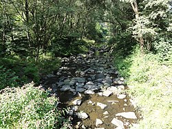
 Ropičanka in Ropice | |
| Location | |
| Country | Czech Republic |
| Region | Moravian-Silesian |
| District | Frýdek-Místek |
| Villages | |
| Physical characteristics | |
| Source | |
| • location | Ropice Mountain |
| • elevation | 850 m (2,790 ft) |
| Mouth | |
• location | Český Těšín |
• coordinates | 49°43′42″N 18°37′36″E / 49.72833°N 18.62667°E |
• elevation | 270 m (890 ft) |
| Length | 16.4 km (10.2 mi) |
| Basin size | 36.3 km2 (14.0 sq mi) |
| Discharge | |
| • location | Olza |
| • average | 0.62 m3/s (22 cu ft/s) |
| Basin features | |
| Progression | Olza→ Oder→ Baltic Sea |
The Ropičanka (Polish: Ropiczanka) is a 16 kilometres (10 mi)-long stream in the Moravian-Silesian Region, Czech Republic. It is a left tributary of the Olza, which it enters on the outskirts of Český Těšín. The Ropičanka flows through Řeka, Smilovice, Střítež and Ropice (from source to mouth). A small portion of its volume (about 0.07 m³/s or 2.5 ft³/s) is diverted to the watershed of the Stonávka in order to increase the flow rate at the Těrlicko Dam.
References
- Cicha, Irena; Jaworski, Kazimierz; Ondraszek, Bronisław; Stalmach, Barbara; Stalmach, Jan (2000). Olza od pramene po ujście. Český Těšín: Region Silesia. pp. 16, 18. ISBN 80-238-6081-X.
